Most people know about UGRC’s awesome base maps. They are very popular and provide high quality cartography using the latest and greatest data from the Utah SGID. But did you know that they provide a WMTS, opens in a new tab service that can be consumed in non-ESRI products? Here’s how to load our base maps in QGIS, opens in a new tab (v3.4.9 as of this writing):
- The first step is to sign up for a free account and request a quad word. This will enable you to authenticate with the
discover.agrc.utah.govbase map server. - Open QGIS and right click on “WMS/WMTS” in the browser panel and select “New Connection”.
- Give the new connection a name and paste in this URL:
https://discover.agrc.utah.gov/login/path/{your-quad-word-here}/wmts/1.0.0/WMTSCapabilities.xml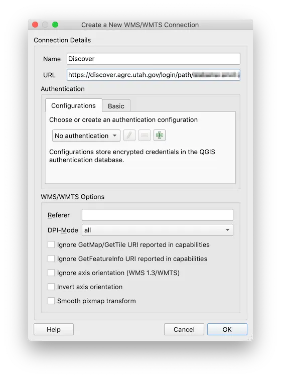
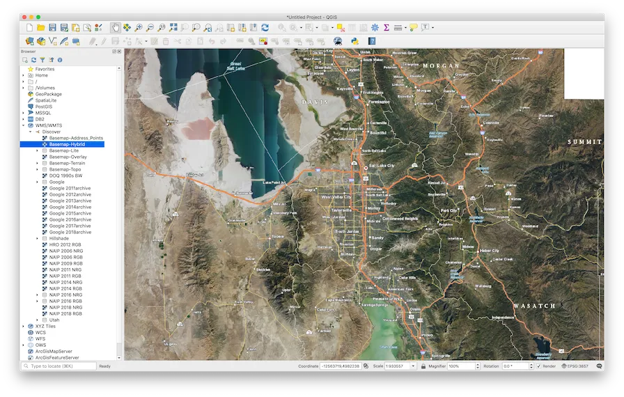
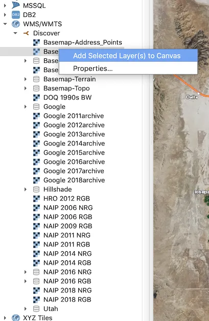
- You should now see a new connection in the browser panel under “WMS/WMTS”. Expand the new connection and right-click on a layer and select “Add Selected Layer(s) to Canvas”.
- You should now be able to view the base map as a layer in QGIS!