Using High Resolution Data and State-of-the-Art Modeling to Produce Flood Information for Utah Communities
Risk Mapping, Assessment, and Planning (Risk MAP) is the Federal Emergency Management Agency (FEMA) Program that provides communities with flood information products, risk assessment tools and planning and outreach support. Each Risk MAP flood risk project is tailored to the needs of each community and may involve different products and services. The goal is to strengthen local ability to make informed decisions about reducing risk from flooding.
In Utah and most other states, FEMA uses partnerships to deliver high-quality mapping products, risk assessment tools, and planning and outreach support. Here in Utah, FEMA’s Cooperating Technical Partner is the Utah Division of Emergency Management (DEM). Utah’s Floodplain Mapping Program is actively collecting data and working with highly qualified engineers, counties and communities to create, update and digitize flood risk information all over the state.
What kind of flood information do you need?
Flood Risk Information for Property Owners
Are you in a floodplain? What does it mean if you are? How property owners can reduce personal and financial risk.
Resources for Mapping Partners
Mapping process, appeals, floodplain models, levees, base flood elevations, communicating risk, and more.
Mitigation Resources
Types of flood mitigation, case studies, and where to look for mitigation assistance.
Floodplain Mapping Products
Products might include maps, reports, data, special studies, and/or training in areas of community interest
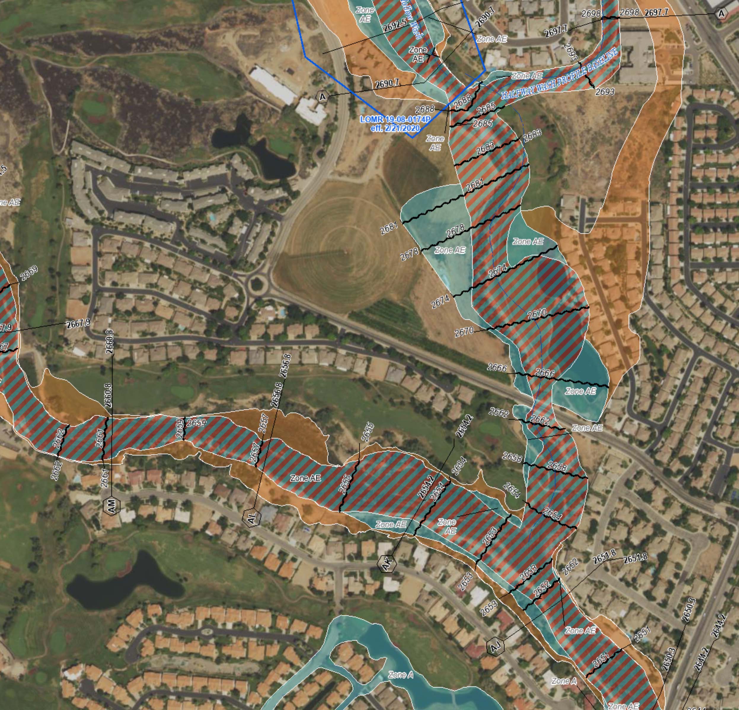
How to Read and Understand Flood Maps
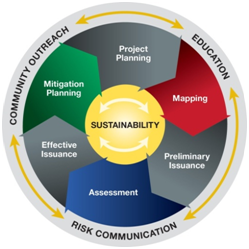
Lifecycle of a Floodplain Mapping Project
Active Project Websites
Click on the thumbnails below to Risk MAP data and documentation for the various stages of that project.
Not all projects have websites—just those beginning in 2020 or after.