National Agriculture Imagery Program (NAIP)
Last update · 2024
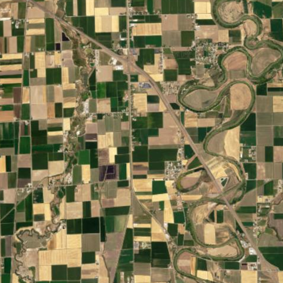
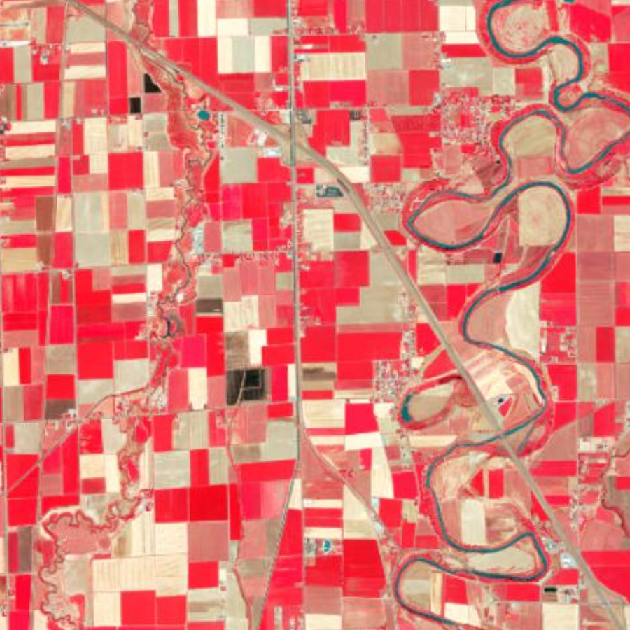
The National Agriculture Imagery Program (NAIP) , opens in a new tab collects aerial photography every 2 or 3 years in the middle of the summer. Starting in 2006 the acquisitions have been statewide. The resolution is usually 1 meter with a horizontal positional accuracy of -/+ 5 meters. The 2018 and newer imagery is .6 meter (60 centimeter) resolution with a horizontal positional accuracy of -/+ 4 meters. In addition to the 3-band RGB color imagery, there is color-infrared imagery for most years. Currently there is NAIP imagery from 2003, 2004, 2006, 2009, 2011, 2014, 2016, 2018, and 2021. Utah was recollected in 2024 and the Mr. Sid Compressed County Mosaics (CCMs) are available for download. Services of the 2024 imagery will be available soon.
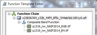
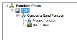
Although the NAIP imagery collection is typically 4-band imagery, we have separated the Red, Green, and Blue (RGB) bands from the Infrared band to support most software platforms. To merge the RGB images with the single infrared band to create a 4-band image you can use the ArcGIS Composite Bands (Data Management) tool, the Image Analysis window to add a Function Chain, or create a Reference Mosaic. 3-band Mr. Sid county mosaics are also available.
Get the data
A closer look
All NAIP imagery has a UTM NAD83 Zone 12 North meters projection.
For more information about the history of the NAIP collections take a look at this Map Tour , opens in a new tab from the USDA or visit their NAIP GeoHub , opens in a new tab . A 4-band imagery service of the most current NAIP imagery for all the states in the U.S. is also available from USDA. The USDA NAIP GIS Service URL is https://gis.apfo.usda.gov/arcgis/rest/services/NAIP , opens in a new tab .
Finding flight dates
The date the photography was flown for the year of interest can be found in the list below.
2024
2021
-
Within the
SrcImgDatefield of the NAIP2021 Index shapefile , opens in a new tab or - the
SDATEfield of the county mosaics shapefile.
2018, 2016, 2014
-
Within the
SrcImgDatefield of the NAIP2018 Index shapefile , opens in a new tab , - in the
.txtmetadata files afterCalendar_Datein the image tile, - or the
SDATEfield of the county mosaics shapefile downloaded from the Raster app.
2011
-
Within the
SrcImgDatefield of the NAIP2011_4-band_Index shapefile , opens in a new tab , -
in the
IDATEfield in the NAIP2011_4-band_FlightDate_Index shapefile , opens in a new tab , - or the
SDATEfield of the county mosaics shapefile downloaded from the Raster app.
2009
-
Within the
SrcImgDatefield of the NAIP2009 Index shapefile , opens in a new tab - or the
SDATEfield of the county mosaics index file downloaded from the Raster app.
2006
-
FLIGHT_DATfield of the NAIP2006 Index shapefile , opens in a new tab - or the
.txtmetadata files downloaded from the Raster app.
2004
-
Within the
IDATfield of the compressed county mosaic index downloaded from the Raster app.
2003
- Within the
.txtfile of county mosaic downloaded from the Raster app.
More resources
NAIP 2024
Download from raster app.
NAIP 2021
Download from raster app.
NAIP 2018
Download from raster app.
NAIP 2016
Download from raster app.
NAIP 2014
Download from raster app.
NAIP 2011
Download from raster app.
NAIP 2009
Download from raster app.
NAIP 2006
Download from raster app.
NAIP 2004
Download from raster app.
NAIP 2003
Download from raster app.
Utah Geological Survey (UGS) Scanned Aerial Imagery
1935-Present scanned aerial imagery.