From the blog
Currently displaying: Bert Granberg
2020 Census Redistricting Data in Easy to Use GIS Formats (4 min)
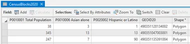
Good news, 2020 census redistricting data is now available for Utah in easy to use GIS formats!In mid-August, the Census Bureau published the PL 94-171 Redistricting Data Summary Files from the 2020 C
Utah Recognized in NSGIC Geospatial Excellence Awards (2 min)
Through its Geospatial Excellence Awards, the National States Geographic Information Council (NSGIC) recognizes individuals and organizations that advance the capabilities of geospatial technology, an
Where and How? High Resolution Base Maps and Google Imagery Usage (4 min)
It has been about 18 months since the statewide high resolution (6") aerial photography content and services, licensed from Google and funded through the Utah Mapping and Information Partnership (UMIP
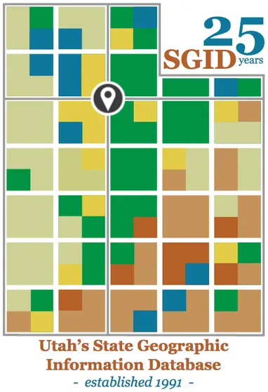
25 Years Ago: Laying the Foundation for Utah GIS Success (3 min)
For those of us not in the GIS field at the time, 1991 was a significant year in Utah and beyond...In March of 1991, Governor Norman Bangerter signed into law Senate Bill 21, sponsored by Senator Dixi
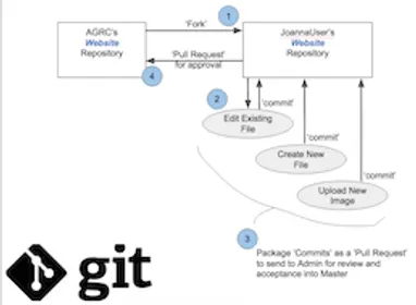
Now You Know: About the gis.utah.gov v6.0 Refresh (4 min)
Four years is a long time for anything, and that certainly applies to website releases. For a number of reasons, gis.utah.gov, has been overdue for a refresh.In releasing the new, updated gis.utah.gov
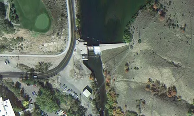
Utah Acquires High Resolution Aerial Photography License (8 min)
Last month (January 2015), UGRC led an effort to purchase a license to Google's statewide high resolution aerial photography (6" pixels) on behalf of a partnership of state, regional, and local govern