From the blog
Currently displaying: Discover
Celebrating Ten Years of Discover (6 min)
We are celebrating 10 years of the Discover Basemap and Imagery Server this month! Discover is our one-stop shop for aerial imagery and custom Utah basemap services, all available from UGRC for free t
Getting Better Resolution from Raster Tile Imagery in Large Maps (5 min)
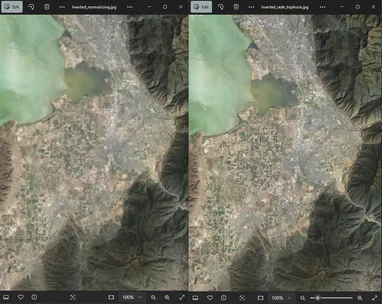
Have you ever added one of our WMTS Discover imagery layers to a map covering a large extent (a small-scale map) in ArcGIS Pro and tried to export it to a large PDF, only to have the imagery come out
UGRC Purchase of Hexagon Imagery (4 min)
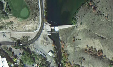
UGRC recently purchased a license to Hexagon’s statewide high resolution aerial photography (6” and 12” pixels) on behalf of Utah state, regional, and local government organizations. Since the purchas
Where and How? High Resolution Base Maps and Google Imagery Usage (4 min)
It has been about 18 months since the statewide high resolution (6") aerial photography content and services, licensed from Google and funded through the Utah Mapping and Information Partnership (UMIP
Utah Acquires High Resolution Aerial Photography License (8 min)
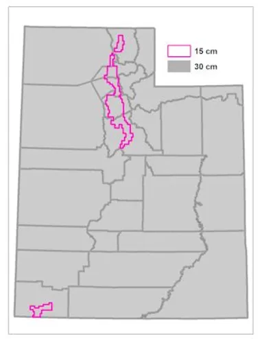
Last month (January 2015), UGRC led an effort to purchase a license to Google's statewide high resolution aerial photography (6" pixels) on behalf of a partnership of state, regional, and local govern