What is the Open SGID
The Open SGID is a cloud hosted, publicly available PostGIS database containing our curated SGID data. This database is one part of the SGID and complements the web services and data downloads offered on the SGID on ArcGIS , opens in a new tab .
To search the SGID, visit the SGID Index. View the organized data categories available in the SGID on the SGID category page.
Getting connected
There are a variety of clients and applications that can connect to a PostgreSQL database. The DNS, username, password to connect to the Open SGID can be found on the Open SGID GitHub repository , opens in a new tab . Below are a few of the more common applications and how to connect using them.
Tip
- Take a moment to read over the Open SGID Terms of Use.
- Get familiar with the Open SGID GitHub repository , opens in a new tab , where you can troubleshoot and track known issues.
Connect with ArcGIS Pro
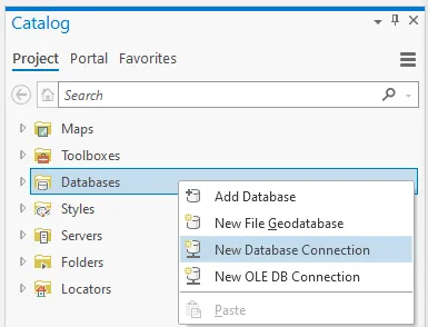
- Open the Catalog pane, right-click Databases, and select New Database Connection.
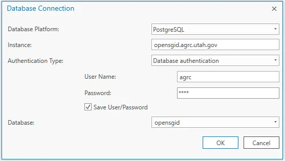
- Enter the connection information found on the Open SGID GitHub repository , opens in a new tab .
Connect with DBeaver
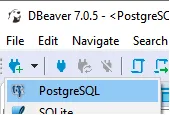
- Click the New Database Connection button and choose PostgreSQL.
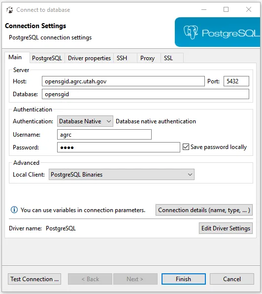
- Enter the connection information found on the Open SGID GitHub repository , opens in a new tab .
Connect with QGIS
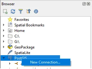
- Navigate to the Browser pane and right-click PostGIS then click New Connection....
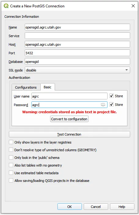
- Enter the connection information found on the Open SGID GitHub repository , opens in a new tab .
Connect with Global Mapper
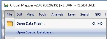
- Click File, and select Open Spatial Database....
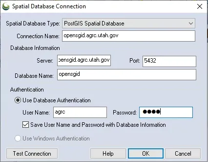
- Enter the connection information found on the Open SGID GitHub repository , opens in a new tab .
Connect with GeoPandas
- Create a sqlalchemy engine using the connection string postgresql://username:password@opensgid.ugrc.utah.gov:5432/opensgid.
- Create a SQL query using the Open SGID sample query from a layer's SGID data page.
- Use gpd.read_postgis() with your engine and SQL query, passing in geom_col="shape" to set the geometry column.
import geopandas as gpd
from sqlalchemy import create_engine

url = "postgresql://agrc:agrc@opensgid.ugrc.utah.gov:5432/opensgid"
opensgid_connection = create_engine(url)

sql_query = "SELECT * FROM boundaries.county_boundaries"
county_boundaries = gpd.read_postgis(
    sql_query,
    opensgid_connection,
    geom_col="shape")