Parcels - collaboration
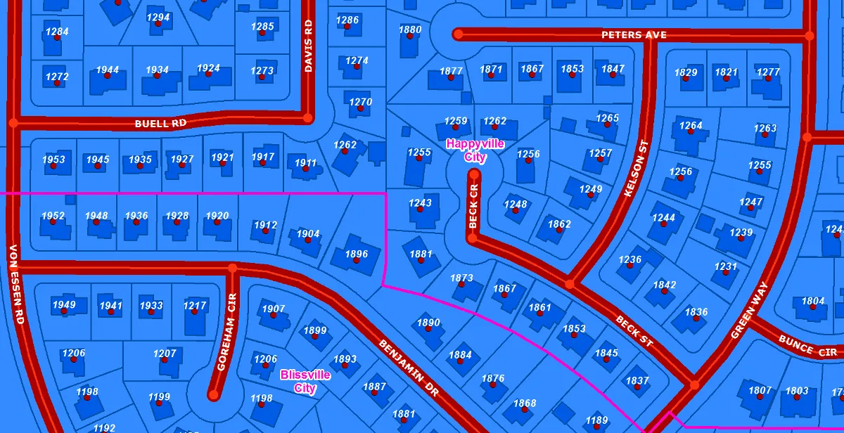
Our state-wide parcel boundary dataset is the most-visited data page on our website, and for good reason: property boundaries (even their rough, un-surveyed approximations in GIS) are a foundational layer for many maps. They facilitate both commercial activity and private property management.
This statewide collection would not be possible without the cooperation of counties across the state who send us updates to their parcel data on a regular basis. We merge them into a single, consistent hosted dataset available to anyone for free.
Roads - collaboration
We are fortunate to have the luxury of free, up-to-date, and comprehensive road data. Thanks to the contributions of cities, counties, and UDOT, cartographers and analysts don't need to download road data from five different places with five different schemas, nor do they need to pay a commercial company to access data their tax dollars have already paid for. It's all here in one hosted dataset.
Historical aerial imagery - sharing
The Utah Geological Survey has also spearheaded the monumental task of scanning and roughly locating all the historic imagery they could find. These scans give a glimpse into the past and are useful to track changes in land use over time. We help make them discoverable by sharing the link to their interactive map in the SGID Index.
Land ownership - sharing
Sometimes a project needs a 10,000-foot overview of land ownership, especially in Utah where large amounts of land are owned by private individuals, the state, and the federal government. Utah has tasked the State Institutional Trust Lands Administration (SITLA) with maintaining a state-wide land ownership layer as part of their responsibilities, which they share on their website , opens in a new tab . Because this is such an important and fundamental dataset, SITLA also shares the data with the Open SGID and the SGID Open Data site for easy access to all.
Natural hazards - sharing
A key part of the land development process is identifying any natural hazards that may impact a project. In the past, we have hosted the Utah Geological Survey's natural hazard layers in the precursor to the Open SGID database. However, it became a burden to maintain a separate copy of their data as they constantly update their internal data with newly mapped areas.
To improve access, we've worked with UGS to replace their Open SGID layers with their ArcGIS Online feature services available through the SGID on ArcGIS , opens in a new tab . This sharing method ensures there is only one copy of the data and updates are immediately available.
UGRC-created collaborative datasets
Some collaborations take the form of support for UGRC-created hosted datasets. For example, under the direction of the Lieutenant Governor's office, we map all the changes to city boundaries from annexations, incorporations, and disconnections to create a statewide municipal boundary dataset. We also coordinate among various state and federal agencies to collect Lidar data for as much of the state as possible. Finally, with the support of the state legislature and cities and counties across the state, we spearhead the acquisition of state-wide, high-resolution aerial imagery.